
Over on Twitter I’ve been posting a series of images comparing old photos of Bangkok with the same location as seen from Google Street View. It wasn’t a project I planned, but I stumbled onto a thread of old pics on TeakDoor.com dating from 2008 and started scrolling. I saw one that I thought might make a good comparison pic, and it worked out pretty well. So I kept going.
I soon became obsessed and over a few weeks managed to through all 300 pages of posts, pulling out about 30 photos that I could compare. Thank god I’m stuck at home.
The photos don’t always match exactly – for instance, one old photo may have been taken on the sidewalk, but using Street View I’m limited to where the photo was taken from whatever lane the Google car was driving in. You also have differences in lenses, etc, but I think it works okay.
If you like nerdy stuff like this, check out this very similar post based on the book Bangkok Then & Now by Steve Van Beek. Kudos to actual photographers like Steve who actually get out and take the photos themselves instead of doing it from behind a computer. But hey, think of it as a lockdown project.
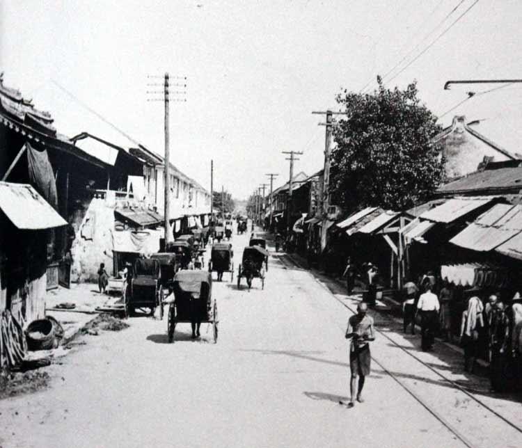
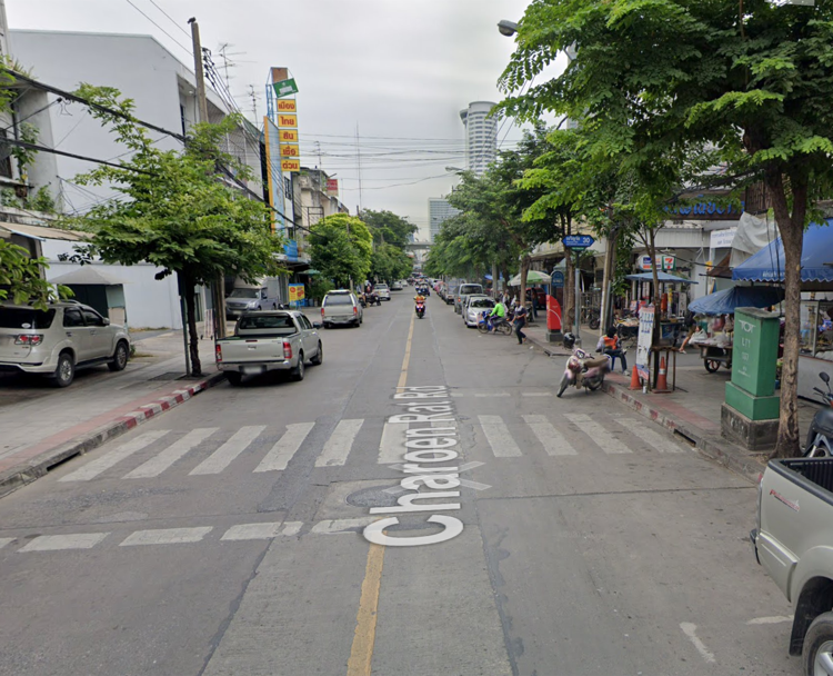
Charoenrat Road in 1890 and roughly the same area today. This is looking towards Khlong San Market and the river. Location here.
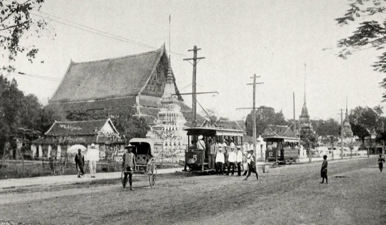
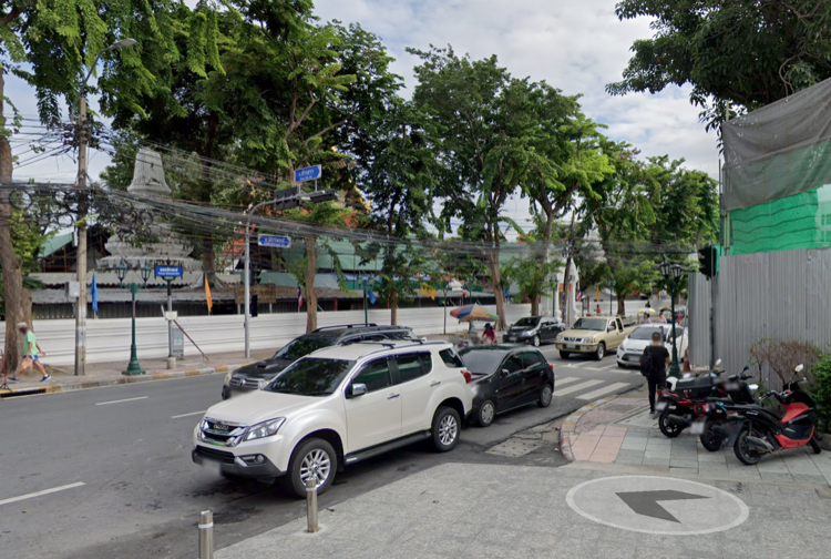
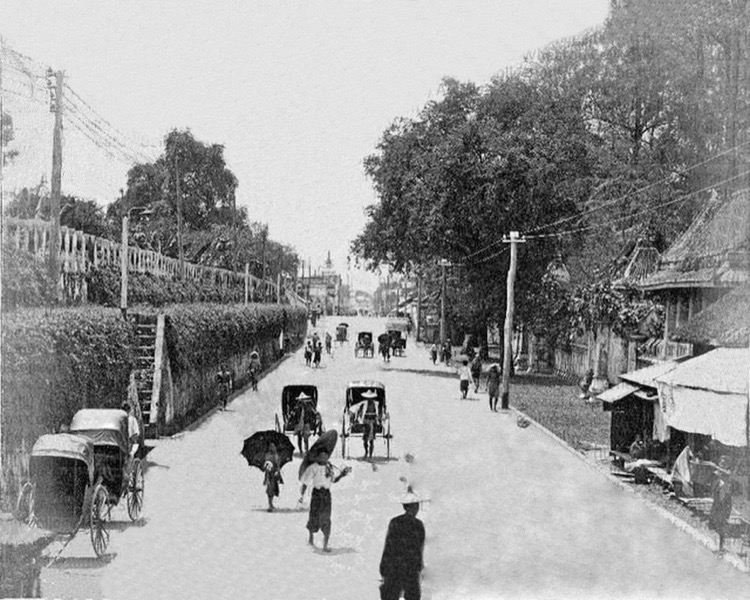
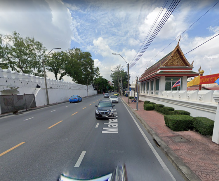
This is Wat Chana Songkhram, the temple at the west end of Khao San Road, in 1890 and today. Location here.
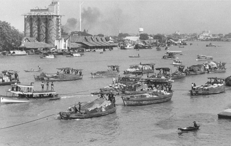
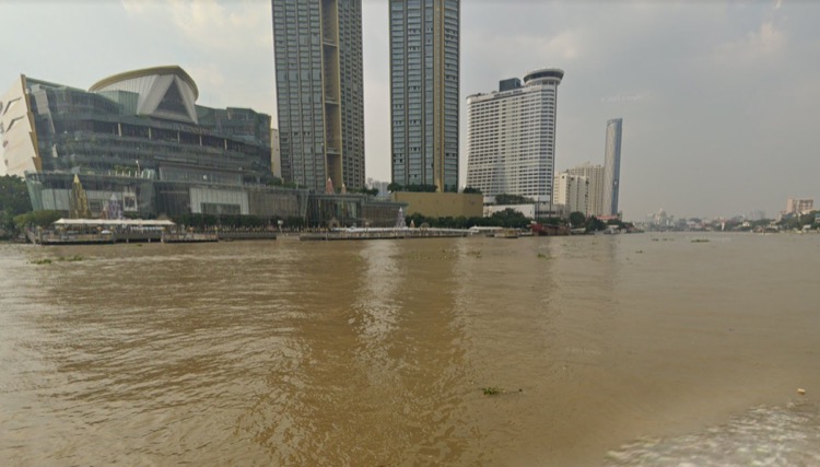
From the Bangkok side of the Chao Phraya River looking across to Thonburi in 1950 and today. The building in the old photo is a rice mill, which was demolished a long time ago. The land was vacant for years until Icon Siam was built. You can still buy rice there, so…I guess that’s a connection? Location here.
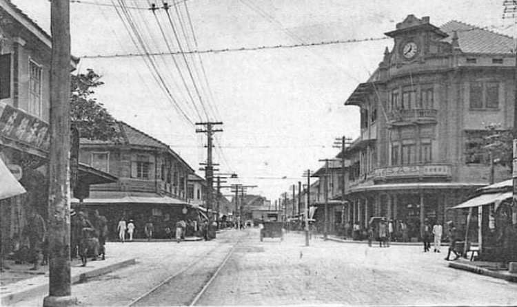
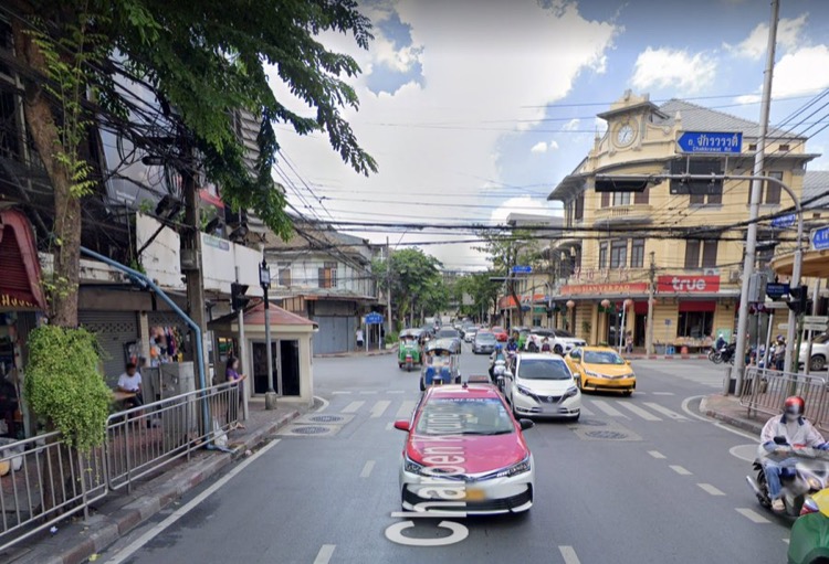
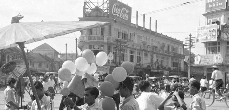
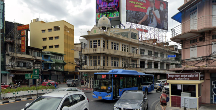
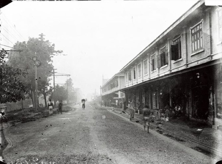
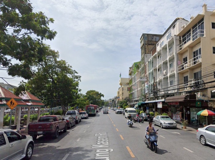
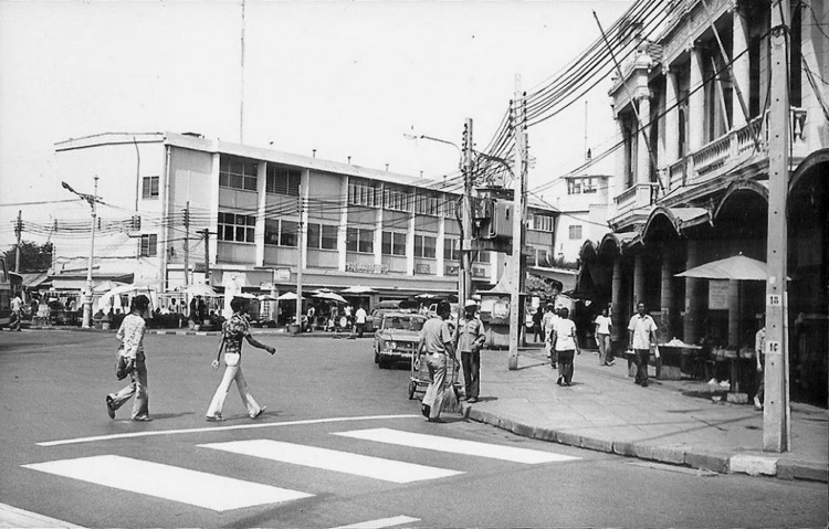
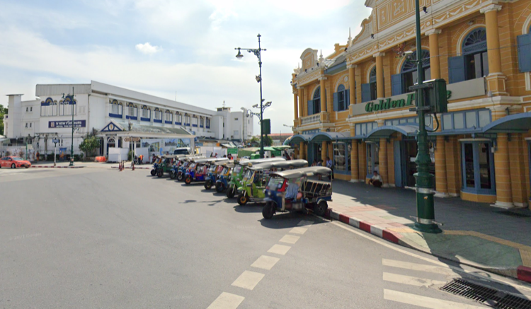
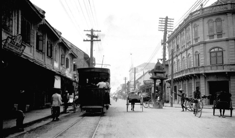
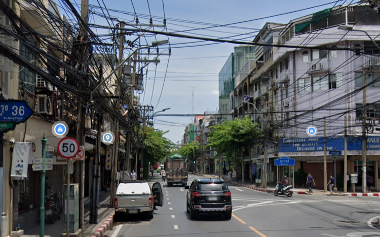
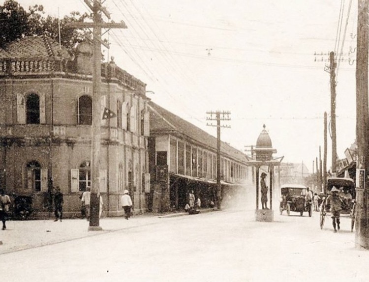
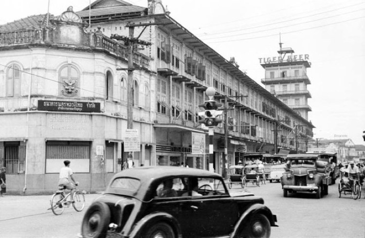
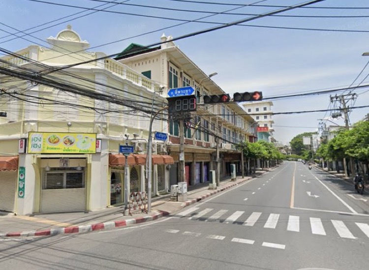
The intersection of Charoen Krung and Thanon Worachek in 1909 and today. Charoen Krung is a long road and there are still plenty of these old buildings there. Many of them look very similar – either one guy designed them all or one guy got pissed when all the other designers started copying him! Location here.
Just west of Hualumphong Train station in 1950 and today. The area back there is a fascinating maze of hardware shops, mechanics, cheap hotels, hip cocktail bars and old shophouses. One wonders how long it’ll be able to hold out. Location here.
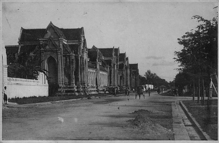
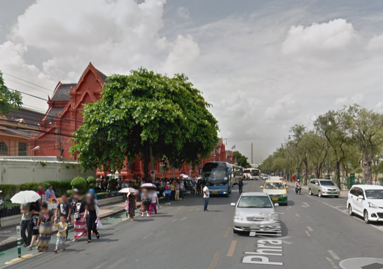
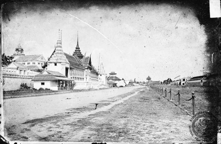
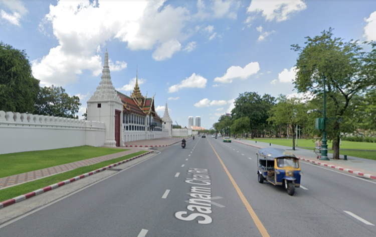
This is Naphrathat Road, right next to Sanam Luang in 1895 and today, with the Grand Palace behind the camera. The building on the left is the Thawornwatthu Building, a museum dedicated to the works of Rama V. Location here.
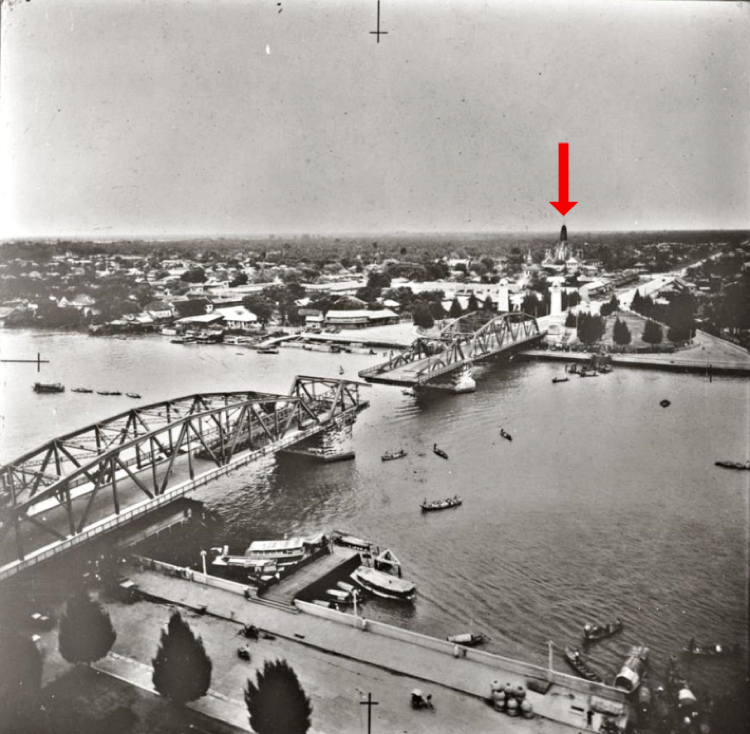
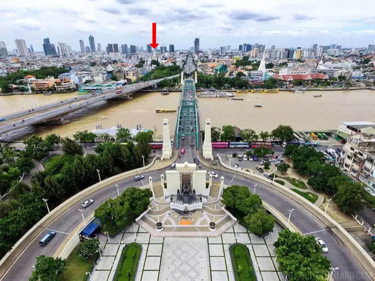
This one’s not exactly a comparison photo but it’s close. This is the Memorial Bridge in 1946 and today. I’ve marked Wat Phitchaya Yatikaram with a red arrow in both photos. Thonburi’s grown up, yo! Here’s Street View on the Memorial Bridge.
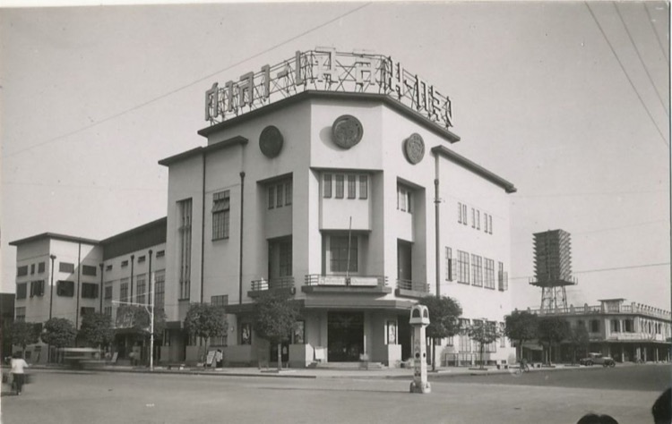
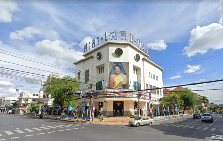
The Sala Chalerm Krung Royal Theatre in 1932 and today. Add it to the list of historical buildings that I’ve driven past but never been inside. 🙁 Location here.
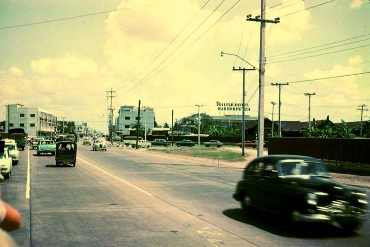
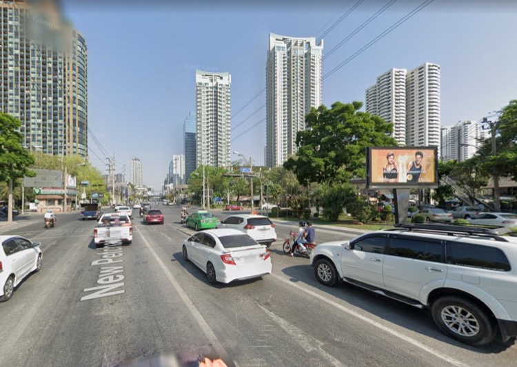
This is Krung Kasem Road in 1892 and today. It’s hard to match up the photos exactly when there are no landmarks, but the original description said it was close to where it crossed Samsen Road, so it’s probably pretty close. Location here.
This is Phetchburi Road where it meets Sukhumvit Soi 3, which of course goes right up to Nana, in 1965 and today. FWIW Phetchburi is my least favorite road in Bangkok, just a long stretch of dusty car dealerships, anonymous offices and ugly shops, most of them shuttered. For my part, I say bring on the gentrification! Location here.
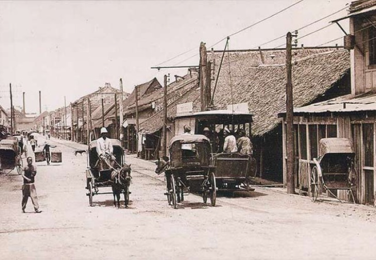
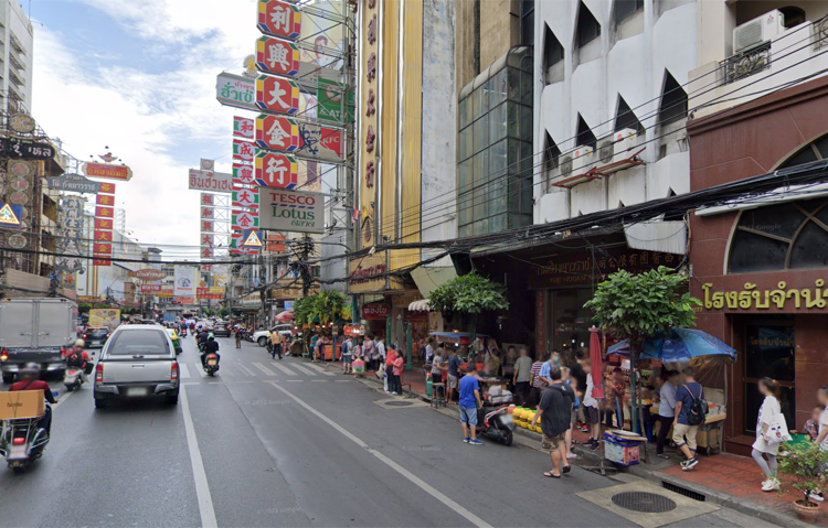
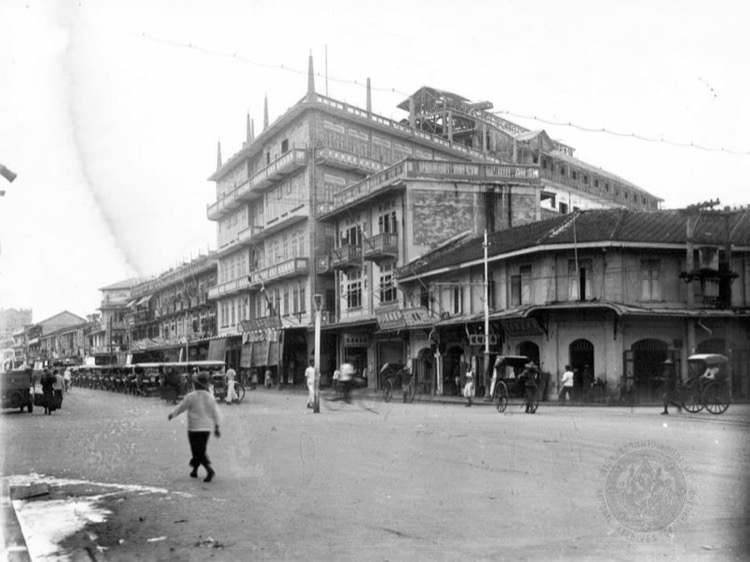
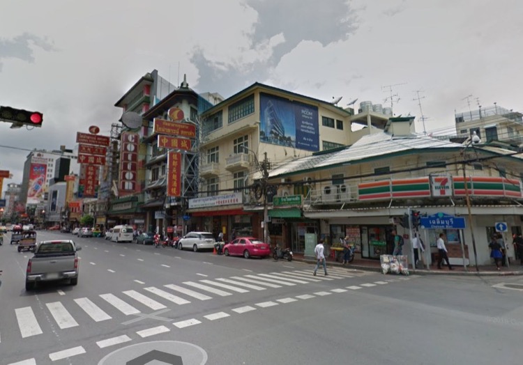
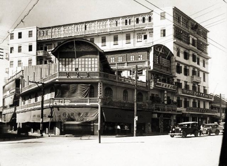
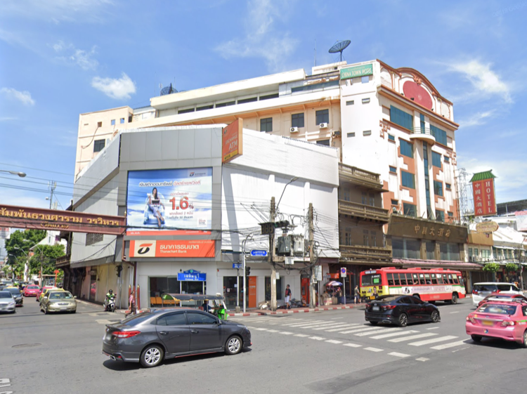
People often say if they had a time machine they’d go back in time and buy stocks in Apple or Amazon, but I figured you’d also be smart to buy a few square blocks of Yaowarat Road back in the day. Here’s roughly the same area in 1896 and today. Location here.
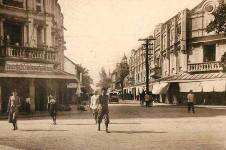
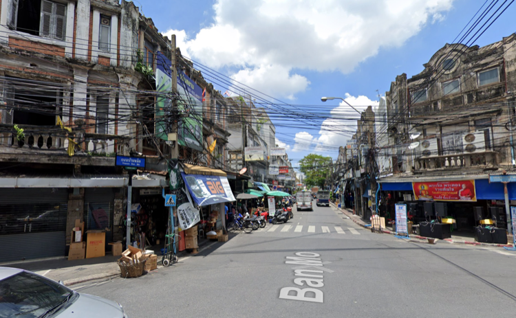
This is the intersection of Phahurat and Ban Mo Roads in 1916 and today. Damn, right around the time my great-grandparents were getting married. Location here.
This is Maharat Road in 1974 and today. If you turn left you’ll see the Grand Palace. If you go right you’ll get to Tha Chang Pier. Location here.
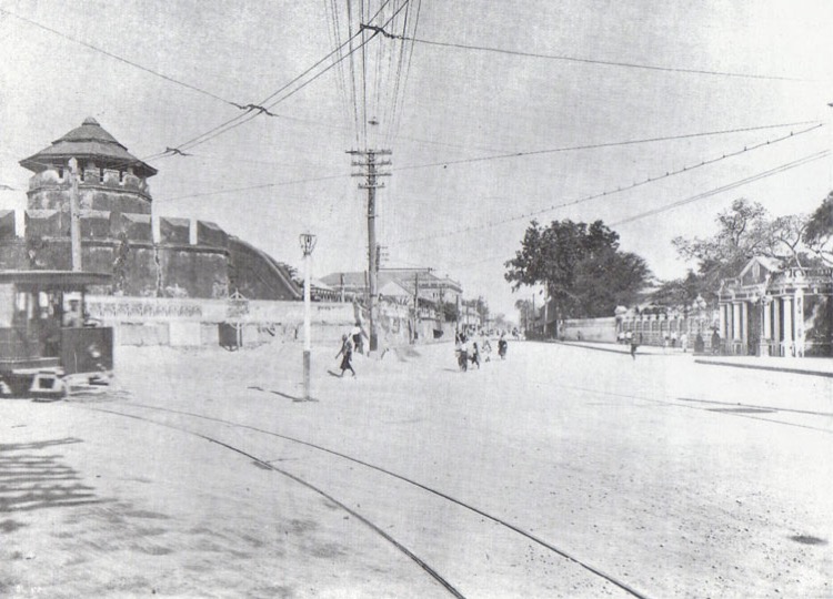
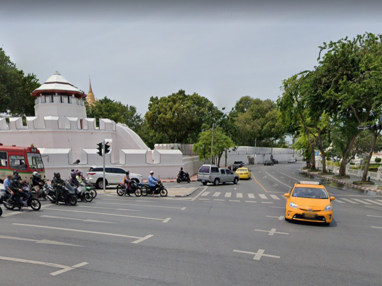
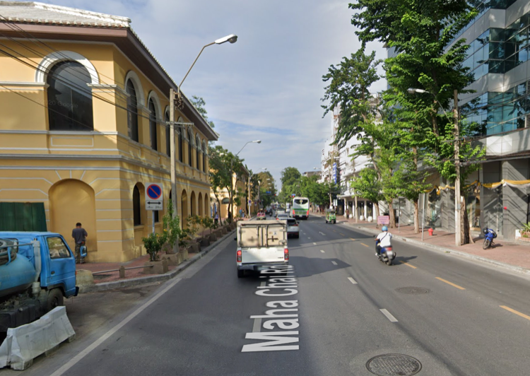
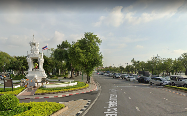
Mahachai Road at Ratchadamnoen Avenue in 1920 and today. We’re looking past Mahakan Fort toward the old city walls, which marked the original boundary of Bangkok. This stretch is one of the last bits that remain. Location here.
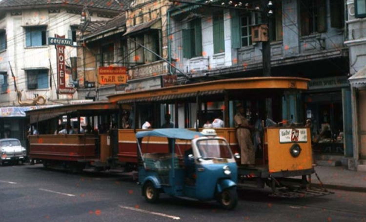
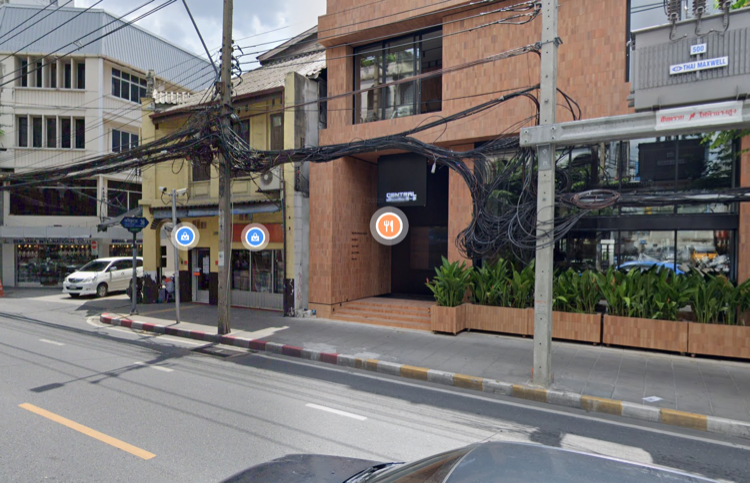
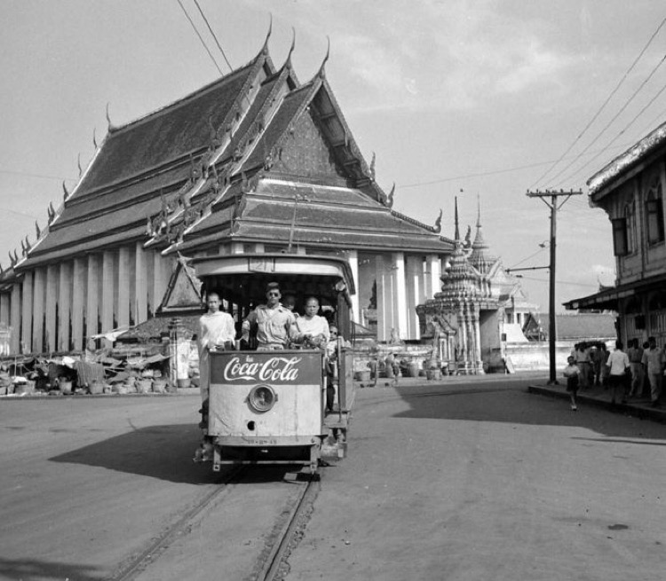
This the inimitable Charoen Krung Road in 1956 and now. Love the race between the old-school tuk-tuk and trolley. Behind the trolley you can see the original location of the first Central store. Boy, they’ve done well for themselves, haven’t they? Location here.
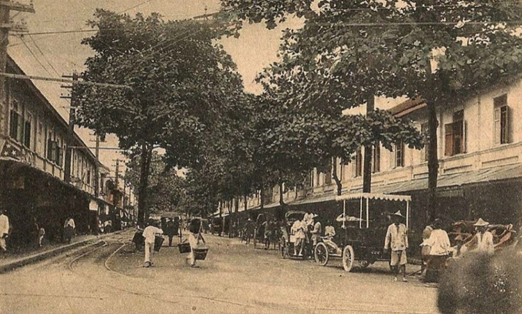
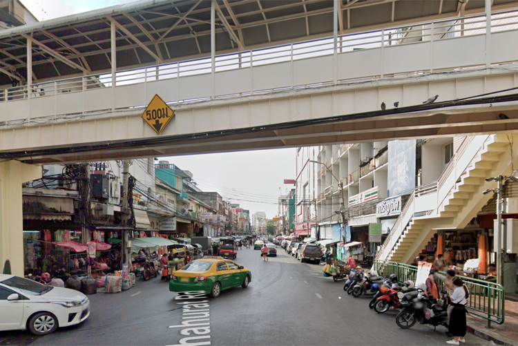
This was a difficult one. Here we see the intersection of Phahurat and Chakraphet Roads in 1908 and today. I’ll summarize the super nerdy details – since there are no identifiable landmarks I compared the trolley tracks in the photo to an old trolley map. On the map you can see where the trolley turns right on “Th.Pahurat” after a quick zag off of Yaowarat. Given that the other end of the tram line on “Th.Pahurat” is next to a khlong and there’s no khlong in the photo, I’m pretty confident that this is correct. Location here.
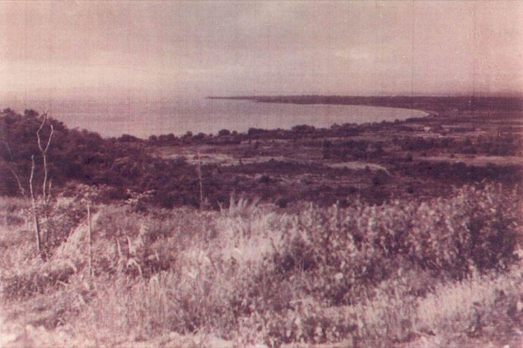
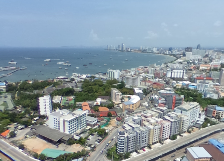
This is probably the most dramatic photo of them all, and a change of scenery. Pattaya in 1952 and now.
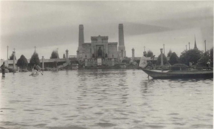
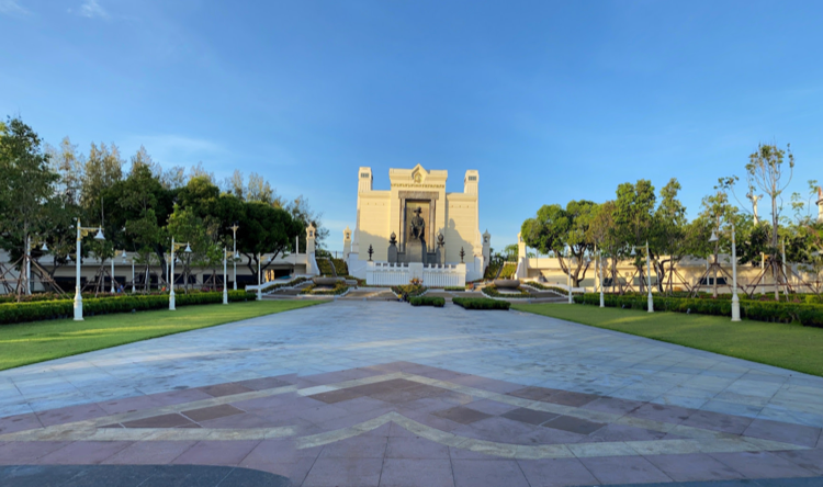
This is a photo of the Bangkok side of the Memorial Bridge during a flood in 1942 and today. Fun fact, they installed some water fountains in front of the Rama I statue years ago, but the water went up too high and obscured the view of the first Chakri king. They were quickly removed. Location here.
Back to Yaowarat in this comparison between 1912 and now. Location here.
Another view from inside the city walls on Mahachai Road in 1904 and now. Note the stairs on the wall, going up to the rampart where defenders would stave off dastardly invaders. Location here.
Another great angle on Charoen Krung Road at the intersection of Surawong, in 1918 and now. Location here.
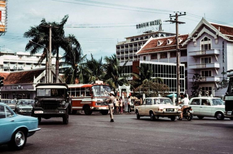
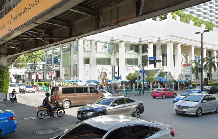
I love this one, it’s so dramatic. This is the Erawan intersection at Ratchadamri and Rama I in 1972 and now. You can see the iconic Erawan Shrine in both photos if you look closely. This place has a lot of historical anecdotes.
One well-known story says that when they were building the original Erawan Hotel here in the 1950’s – back then this area was in the far outskirts of Bangkok – workers kept getting injured and a shipment of marble from Italy meant for the hotel sank. Consultations were made and it was decided that an altar needed to be installed to counteract the bad karma, hence, the new shrine with – somewhat strangely – the Hindu god Brahma. After that, the bad luck stopped.
In 2006 the statue was smashed by a mentally ill man, who was promptly chased down and beaten to death a few hundred meters away. Then in August 2015 a bomb went off at the shrine, killing 20 and injuring 125 (I was working across the street at the time, but had left about an hour earlier). Lots of tragedy and history at this intersection. Location here.
This one’s cool, but it requires two photo sliders, as they only allow two photos. This is the intersection of Charoen Krung and Si Phraya in 1915, 1958, and now. Location here.
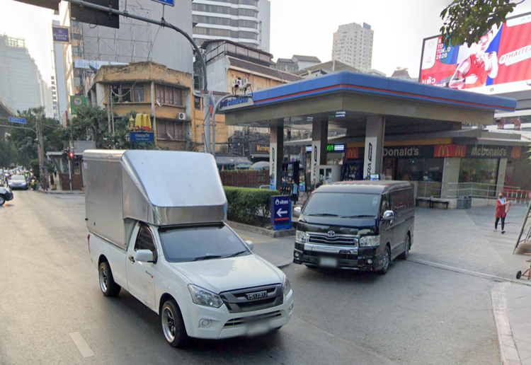
This one’s great. The intersection of Sukhumvit and Soi 4, aka, Nana. Many a late-night hangover has been arrested by snacks at that Mickey D’s. As one of my friends tweeted in a reply to this photo
That gas station saved our drunk asses when we ran out of gas a few blocks away at 3 a.m (Sober driver, old car, malfunctioning gas gauage). A good samaritan on a moped fetched an attendant to come back and help us.
Looking at Wat Pho in 1952 and today. Location here.
This is a great one. Mahachai Road in 1900 and today. The building on the left is the Bangkok Corrections Museum. Location here.
Yaowarat is the gift that keeps on giving. Here’s the intersection with Chaloem Buri Road in 1930 and today. Location here.
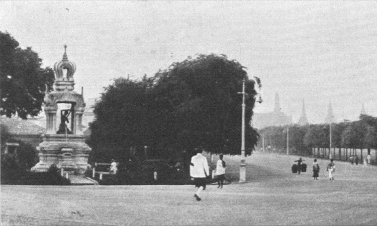
Ratchadamnoen Nai and Nok intersection in 1901 and now. Location here.
And finally, probably my favorite one just for its simplicity. This is Sanam Chai looking past the Grand Palace in 1869 and today. Love that the camera is in almost the exact same spot 150 years apart. Location here.
Leave A Comment